
Stour Valley Path 100km Ultra Run
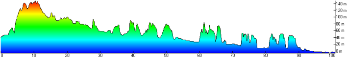
The SVP100 route
Start
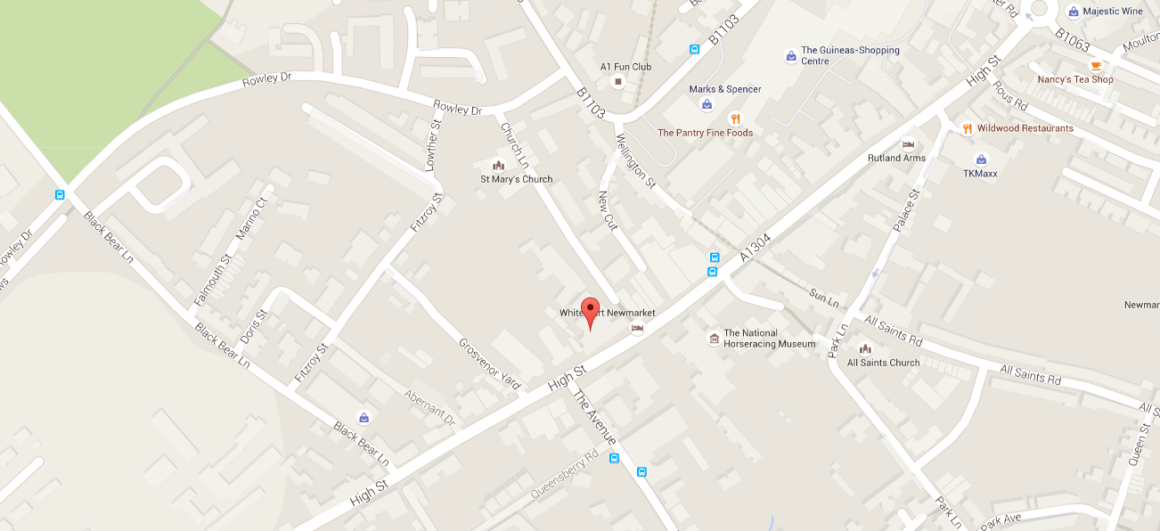
Newmarket – Memorial Hall (CB8 8JS)
Checkpoint locations
CP1. Great Thurlow
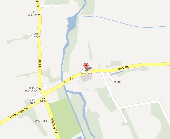
Great Thurlow – Near Church Farm Barn (CB9 7LG)
- Distance: Approx. 12mi (supporters are NOT allowed to park near the CP)
- Info: Suggest parking along the B1061
CP3. Long Melford
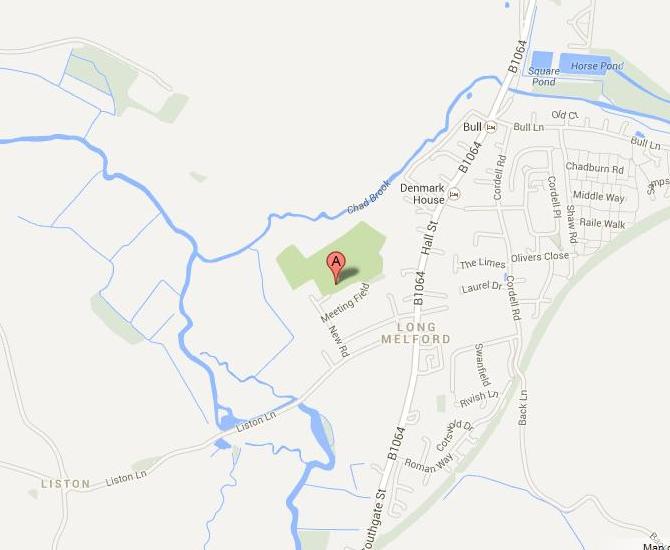
Long Melford – Cricket Club (CO10 9JZ)
- Distance: Approx. 33mi
- Info: Supporters should not park at the cricket club. Please park on B1064
CP5. Nayland
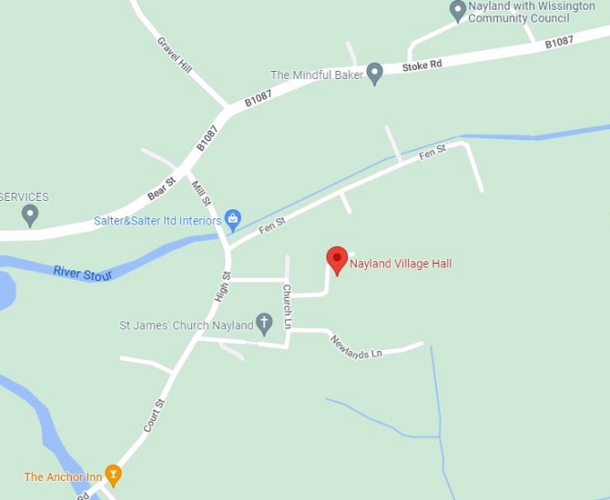
Nayland – Village Hall (CO6 4JH)
- Distance: Approx. 50mi
- Info: Supporters should not park on Court Street
CP2. Clare
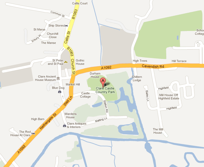
Clare – Clare Castle Country Park (CO10 8NJ)
- Distance: Approx. 23mi
- Info: There is plenty of parking along Malting Lane and on Market Hill
CP4. Lamarsh
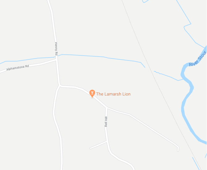
Lamarsh – Lamarsh Lion (CO8 5EP)
- Distance: Approx. 42mi
- Info: Supporters should not park at pub. Please use Village Hall (CO8 5EU)
CP6. Stratford St. Mary
Stratford St. Mary – Near The Black Horse (CO7 6JS)
- Distance: Approx. 58.5mi
- Info: Supporters should not park on the main road. Please use pub car park
Finish
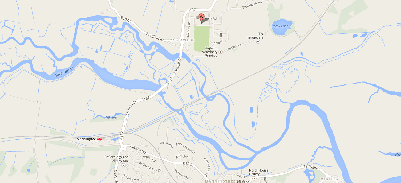
Brantham Leisure Centre (CO11 1RZ)
- Distance: Approx. 63mi
- Links: https://goo.gl/maps/TjPhJ
Maps
A GPX for the route can be found here. You may need to simplify the GPX route if you have problems uploading it to your device, although you shouldn’t experience any issues with newer devices.
If you prefer to use paper based maps, the entire Stour Valley Path is shown on the following Ordnance Survey map series:
- OS Landranger: 154, 155, 168, 169
- OS Explorer: 184, 195, 196, 197, 210, 226
Laminated maps can also be purchased through the Dedham Vale & Stour Valley Project here. A pdf of the route can also be downloaded from the same location and a high level pdf of the race route can be found here.
Finally, the route can be downloaded for the free mobile phone app called ViewRanger here. This is an excellent navigation tool if your mobile phone has good battery life. You can cache the maps before the race and turn your data off during the run to preserve battery life.
Checkpoints table
| CP | Distance | Fastest Runner | Cut-off time from start |
| 1 | ~12mi | ~1hr15 | 3hrs 00mins |
| 2 | ~23mi | ~2hrs45 | 5hrs 30mins |
| 3 | ~33mi | ~4hr30 | 8hrs 00mins |
| 4 | ~42mi | ~6hrs | 10hrs 00mins |
| 5 | ~50mi | ~7hrs15 | 12hrs 00mins |
| 6 | ~58.5mi | ~8hrs15 | 14hrs 15mins |
| Finish | 63mi | ~9hrs | 15hrs 30mins |
There will be no flexibility on these cut-off times. If you enter the checkpoint, or are still at the checkpoint when the cut-off time is implemented, you will not be allowed to proceed. Note that the cut-offs have been calculated based upon previous finishing times, and take into account distance, elevation and other environmental factors.
The following will be provided for runners at each checkpoint:
- Food: Products from the High5, bananas, sweets, pastries, etc.
- Drink: Water, cola, electrolyte.
Hazards
There are a number of hazards that you will encounter during the run. In particular, we would like to make you aware of the following:
Footpaths
At the very start of the run, you will be running along a footpath alongside the Barbara Stradbroke Avenue (A1304). If you need to overtake people, please use the grass verge the runs alongside the footpath, rather than stepping into the road. Additionally, there are two horse crossings that intersect the footpath on this road. Please ensure that you give way to any horses crossing.
Railways
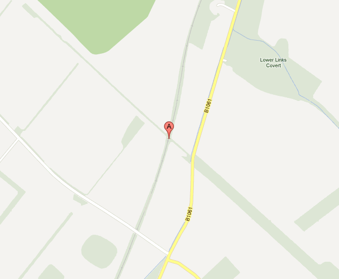
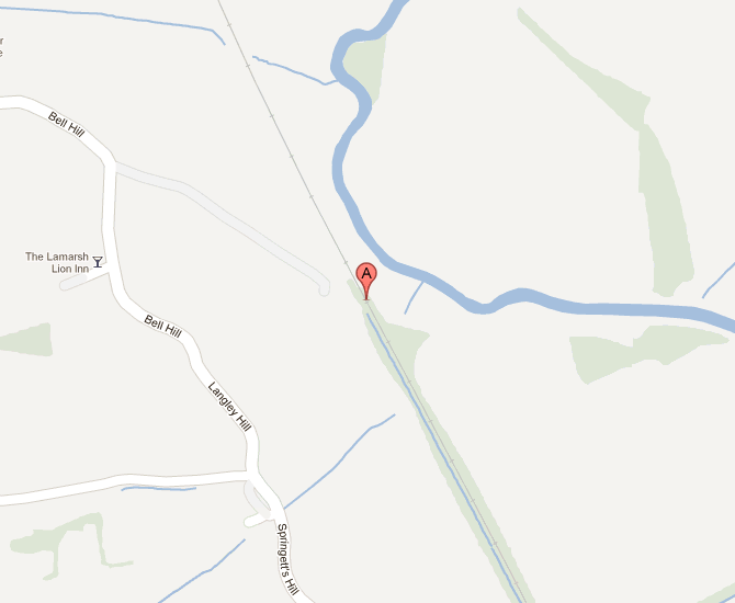
There are two rail crossings on the run, one near the start of the race just after the golf course (when you are running on the Devil’s Dyke), and one situated just after the village of Lamarsh (shortly after CP4). The locations of these crossings are shown in the images below. Please ensure that you stop before these crossings and check to your left and right before crossing the tracks.
Roads
There are also a number of relatively busy road crossings on the run. In particular, the B1061, the A143, Ley Road, the A1092, Middleton Road, and the A137. Please make sure that you stop, look and listen before crossing these roads.
Rain
There are also a number of other potential hazards on the route. For example, there are a number of stiles that you will need to climb over. Furthermore, some parts of the route may become slippery following heavy rain, particularly where there are exposed roots or where the path runs alongside fields.
Rail crossing Newmarket
Rail crossing Lamarsh

Pingback: Come hell or high water | Adventures of a Peanut Nutter
Pingback: Zwischen - Suffolk Babies